Westhaven Gold Corp.
1056 - 409 Granville Street
Vancouver, B.C. Canada V6C 1T2
info@westhavengold.com
Vancouver, B.C. – December 11th, 2019 – Westhaven Ventures Inc. (TSX-V:WHN) is pleased to report additional drill results from its ongoing program at its 17,623 hectare Shovelnose gold property. Shovelnose is located within the prospective Spences Bridge Gold Belt (SBGB), which borders the Coquihalla Highway 30 kilometres south of Merritt, British Columbia.
Highlights include:
Gareth Thomas, President and CEO of Westhaven stated, “We continue to intersect high grade gold in the South Zone. We are dealing with a robust gold-silver system that continues to expand with drilling. We are currently drill testing an exploration target situated approximately 1 kilometre south of the South Zone. We are well-financed and, given the property’s access and proximity to infrastructure, can work the Shovelnose property year-round.”
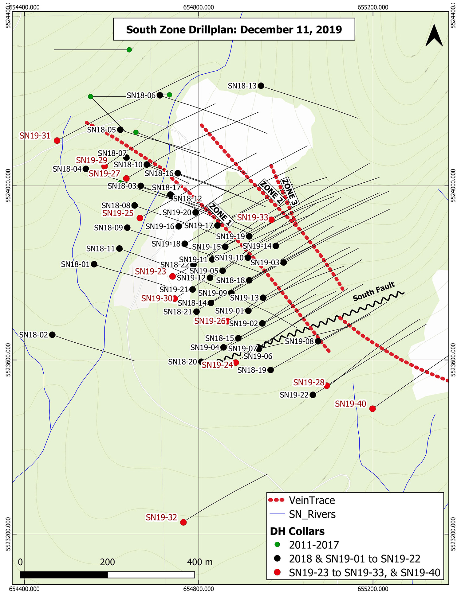
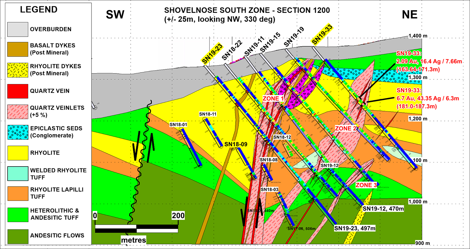
Hole SN19-33, which intersected 6.30 m of 6.70 g/t Au and 43.35 g/t Ag in vein zone 2, is an uppercut to Hole SN19-19, which returned 2.16 m of 100.50 g/t Au on section 1200. Hole SN19-33 is the shallowest intersection of Zone 2, centred at 1240 m elevation here. Follow-up drilling will test this level of Zone 2 on adjacent drill sections, where there appears to be better vein development in a shallower horizon of rhyolite bottoming out at about 1200 m level. An upper cut will be drilled to test for more rhyolite hosted veining up-dip towards the 1300 m level as well.
Hole SN19-36, targeted 100 m southeast of Hole SN19-22, hit the vein zone in the rhyolite - the preferred host rock. The andesite basement was not encountered until 900 m elevation - this is the deepest intersection of this contact between the rhyolite and andesitic basement, strongly suggesting that the vein system and enclosing volcanic stratigraphy dip to the southeast - enhancing the preservation potential of the mineralized boiling horizon. Drilling here is also indicating the overburden is thinning to the southeast, suggesting this horizon may be better preserved due to lesser erosion.
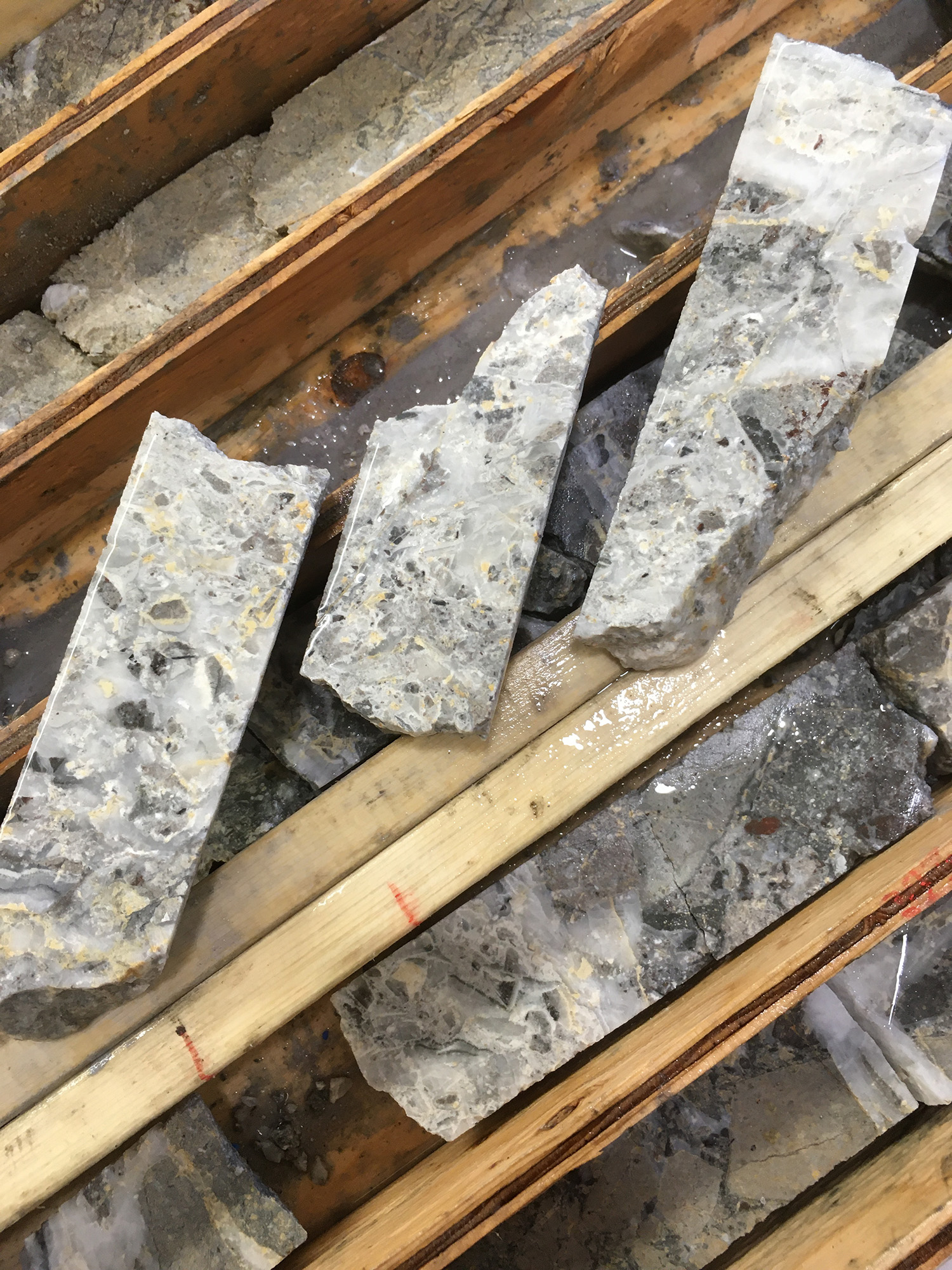
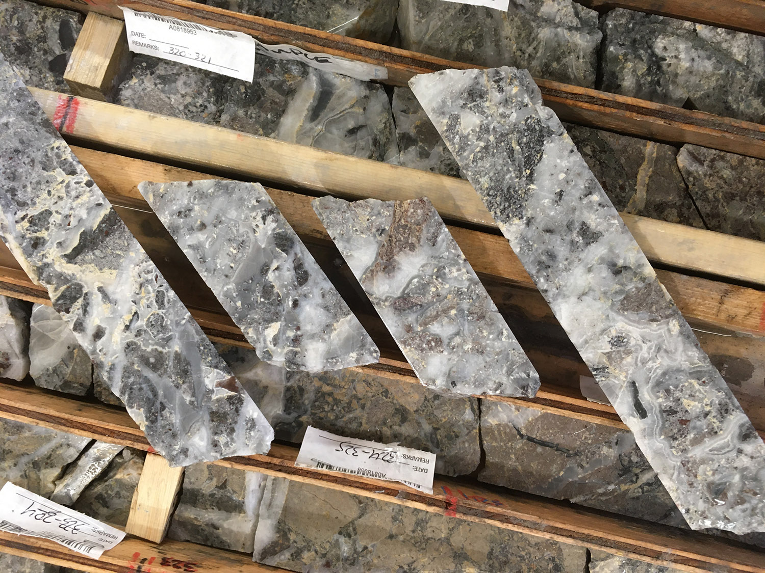
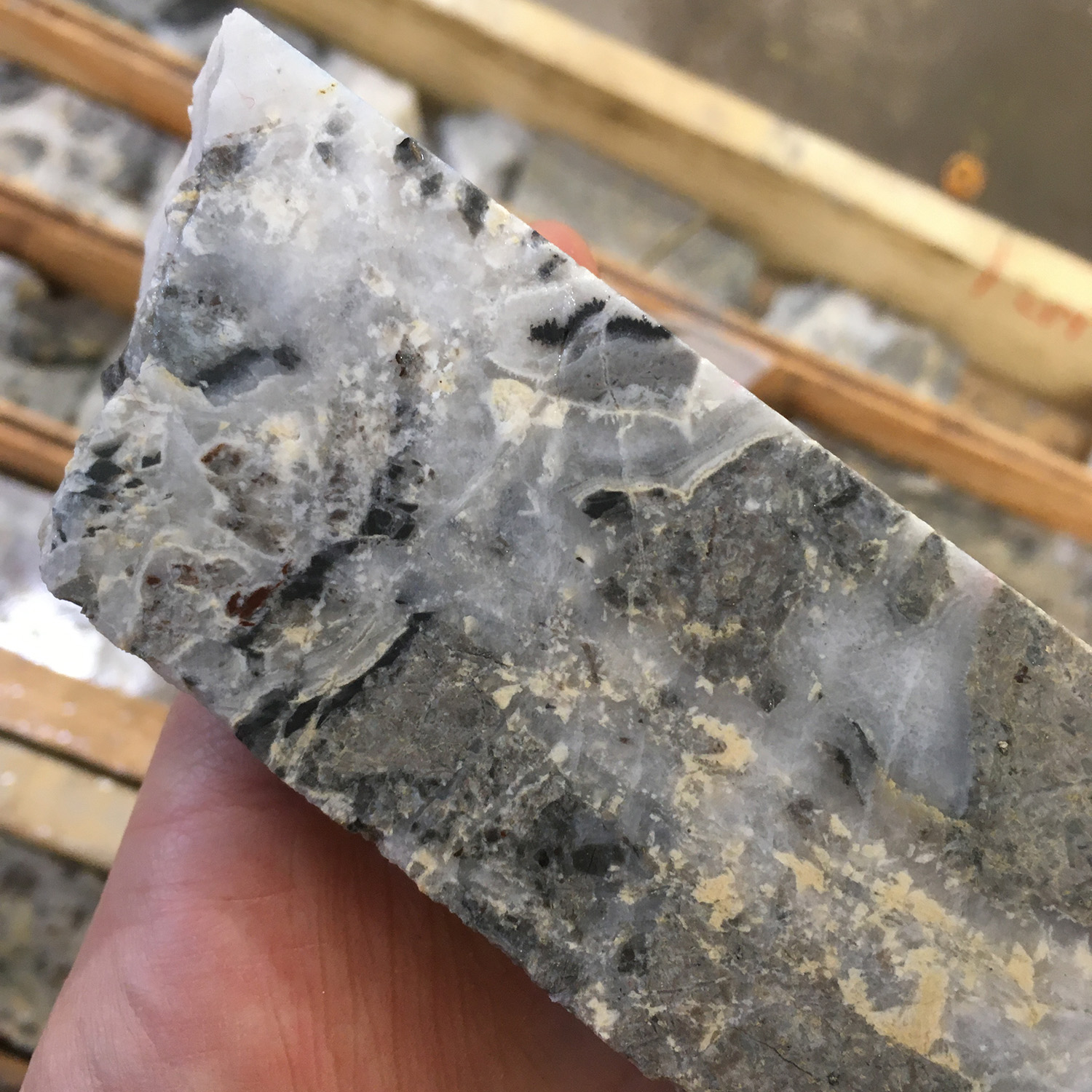
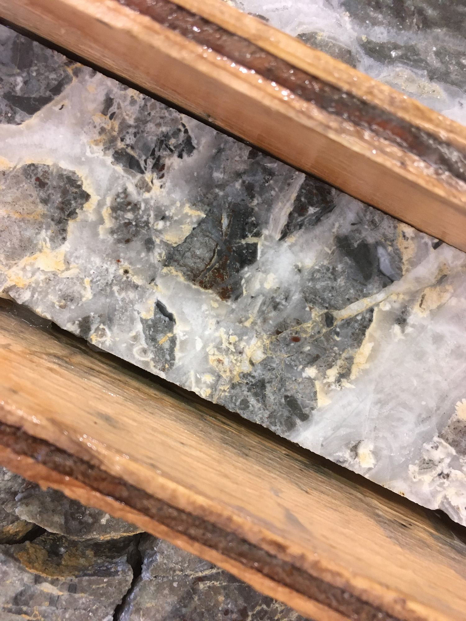
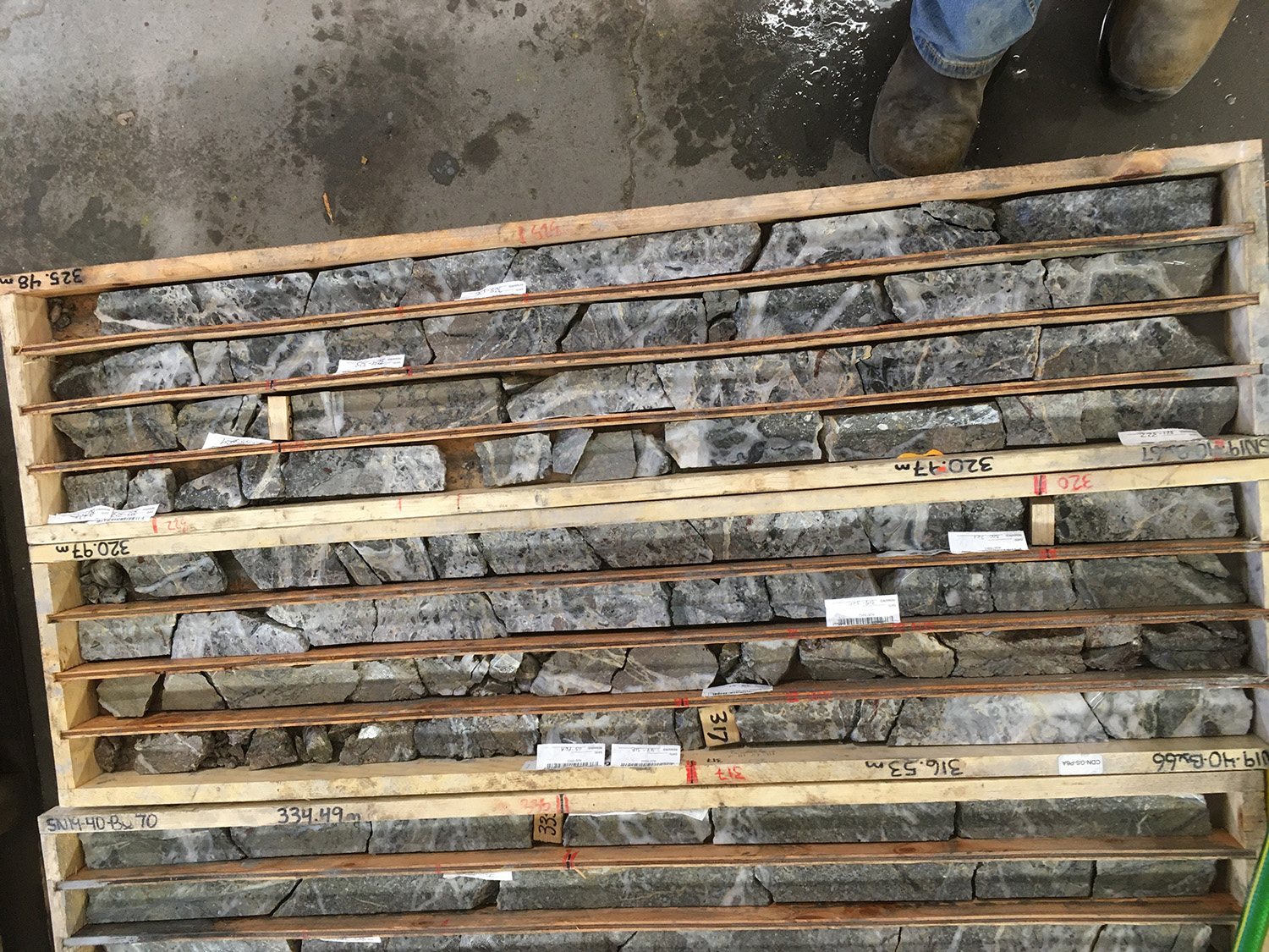
Hole SN19-40, drilled 80 m northeast as a step out from Hole SN19-36, encountered the vein zone in altered basement andesites but at a much shallower elevation. This andesite is likely in the footwall to the normal fault zone that hosts the vein system. The rhyolite in SN19-36 is in the down-dropped hanging-wall of the SW dipping normal fault. This suggests there is a down-drop of over 100 metres. This is the biggest displacement seen so far on this normal fault, strongly suggesting the vein system is present here at the south end, and management believes there is strong potential for the mineralized structure to continue to the southeast. The presence of mineralized quartz veins with adularia and ginguro (please see photos below) but with high silver to gold ratios (0.48 g/t Au and 81.00 g/t Ag) indicates this hole intersected the deeper portions of the boiling horizon. Shallower portions of this horizon will be targeted along strike in follow-up drilling.
| DRILL HOLES SN19-23 to SN19-33 | |||||
| Hole | From (m) | To (m) | Interval (m) | Au (g/t) | Ag (g/t) |
| SN19-23 | 203.88 | 204.55 | 1.58 | 0.78 | 3.61 |
| SN19-24 | NO SIGNIFICANT ASSAYS | ||||
| SN19-25 | 145.58 | 146.74 | 1.60 | 0.99 | 0.94 |
| 156.00 | 159.59 | 3.59 | 0.63 | 1.11 | |
| 167.00 | 187.00 | 20.00 | 0.76 | 2.07 | |
| Incl | 167.00 | 171.20 | 4.20 | 1.61 | 3.96 |
| 304.00 | 306.00 | 2.00 | 1.80 | 3.25 | |
| SN19-26 | 197.00 | 239.84 | 42.84 | 2.63 | 27.80 |
| Incl | 201.46 | 216.92 | 15.46 | 4.80 | 61.51 |
| Incl | 208.35 | 214.00 | 5.65 | 10.64 | 146.00 |
| Incl | 219.70 | 222.70 | 3.00 | 4.00 | 25.45 |
| Incl | 231.00 | 232.00 | 1.00 | 7.00 | 57.60 |
| SN19-27 | 97.00 | 121.35 | 24.35 | 0.23 | 0.49 |
| 178.92 | 275.00 | 96.08 | 0.25 | 1.10 | |
| 346.61 | 347.88 | 1.27 | 0.78 | 22.60 | |
| SN19-28 | ASSAYS PENDING | ||||
| SN19-29 | 130.96 | 132.90 | 1.94 | 1.88 | 11.05 |
| SN19-30 | 281.00 | 284.70 | 3.70 | 1.91 | 23.60 |
| 290.92 | 292.19 | 1.27 | 1.52 | 10.35 | |
| SN19-31 | 103.94 | 104.87 | 0.93 | 1.05 | 5.43 |
| SN19-32 | NO SIGNIFICANT ASSAYS | ||||
| SN19-33 | 110.61 | 111.10 | 0.49 | 8.42 | 6.52 |
| 142.00 | 143.00 | 1.00 | 1.34 | 7.05 | |
| 163.64 | 171.30 | 7.66 | 2.09 | 16.40 | |
| 181.00 | 187.30 | 6.30 | 6.70 | 43.35 | |
*Based on the geology of the vein zones with steep dips to the west, true widths are estimated to be about 80-90% of reported interval lengths. Please see the plan map below.
Regional Exploration:
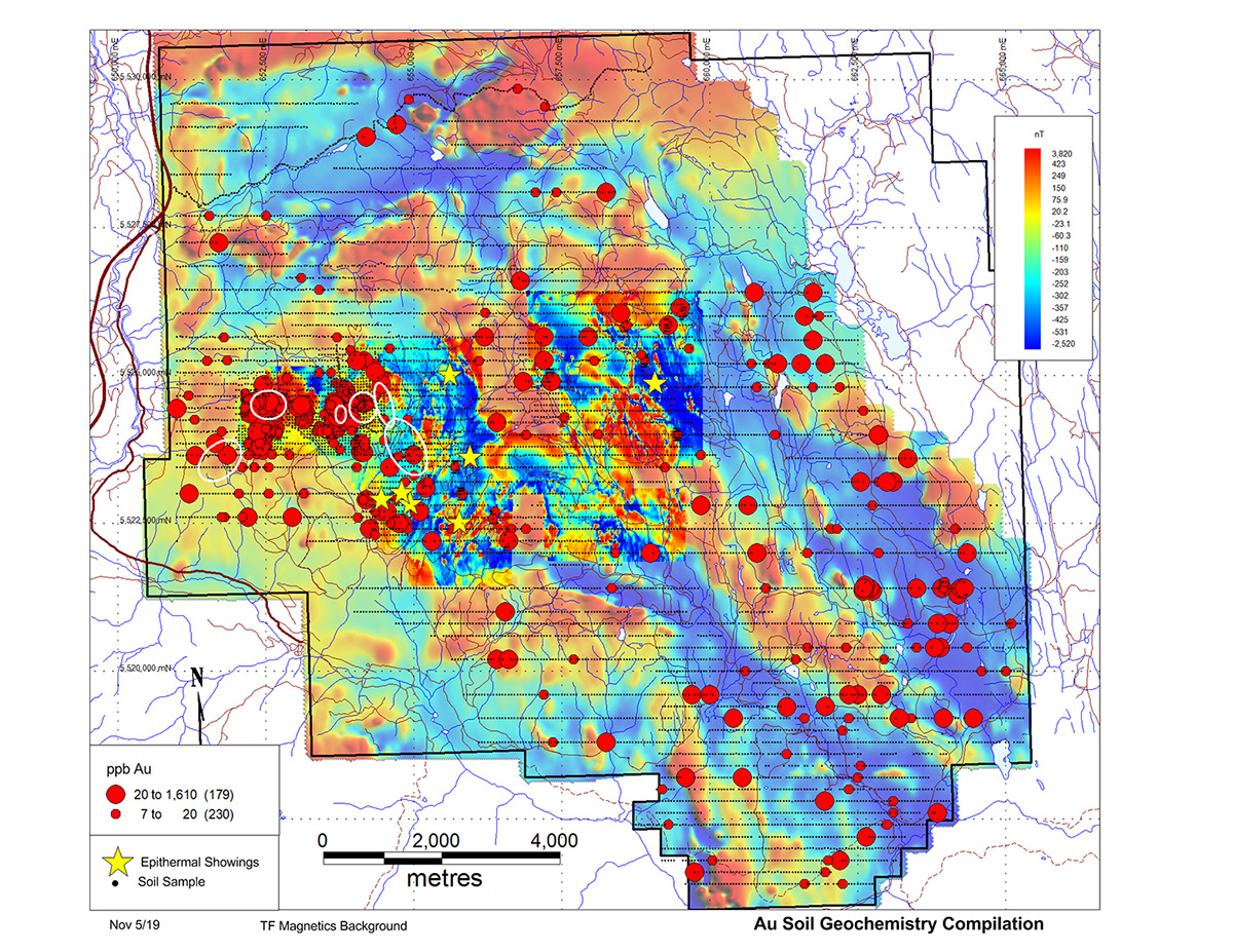
Drilling is now focused on Target D to test resistivity highs defined during a recently completed, DC resistivity survey. This survey spanned 19-line kilometres and extended to 1.5 km south of South Zone. These resistivity highs occur with coincident soil geochemical anomalies identified during detailed (100x50 m) grid sampling carried out this past summer. Drilling here will also test a northwest trending structural break between a magnetic high to the southwest and a magnetic low to the northeast.
Additional Claims:
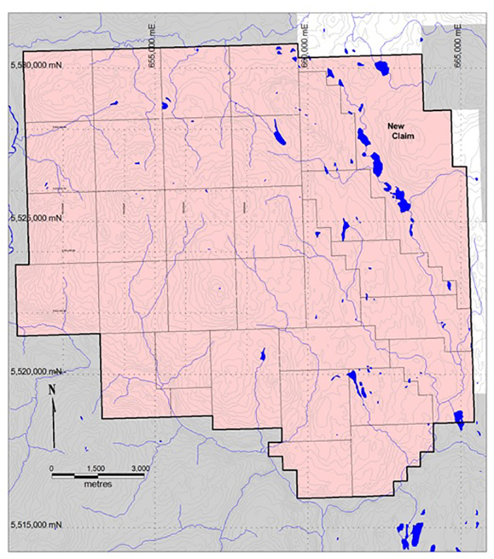
Westhaven has staked an additional 2,081 contiguous hectares off the northeast border of the current claim block. The summer exploration program generated numerous gold-in-soil anomalies including a cluster to the northeast that requires follow-up. The Shovelnose property now comprises 17,623 hectares. Please see the maps below.
Qualified Person Statement
Peter Fischl, P.Geo., who is a Qualified Person within the context of National Instrument 43-101 has read and takes responsibility for this release.
QA/QC
Core samples were prepared using the PREP-31 package in ALS’s Kamloops facility each core sample is crushed to better than 70 % passing a 2 mm (Tyler 9 mesh, US Std. No.10) screen. A split of 250 g is taken and pulverized to better than 85 % passing a 75 micron (Tyler 200 mesh, US Std. No. 200) screen. 0.75g of this pulverized split is digested by Four Acid and analyzed via ICP-MS (method code ME-MS61m (+Hg)), which reports a 49-element suite of elements. All samples are analyzed by Fire Assay with an AES finish, method code Au-ICP21 (30g sample size). Additional Au screening is performed using ALS’s Au-SCR24 method, select samples are dry screened to 100 micron. A duplicate 50g fire assay is conducted on the undersized fraction as well as an assay on the entire oversize fraction. Total Au content, individual assays and weight fractions are reported. All analytical and assay procedures are conducted in ALS’s North Vancouver facility. A QA/QC program included laboratory and field standards inserted every 25 samples. At least one field blank is inserted in every batch of 25 samples, with additional blanks inserted following samples with visible gold.
Neither the TSX Venture Exchange nor its Regulation Services Provider (as that term is defined in the policies of the TSX Venture Exchange) accepts responsibility for the adequacy or accuracy of this release.
On behalf of the Board of Directors
WESTHAVEN VENTURES INC.
"Gareth Thomas"
Gareth Thomas, President, CEO & Director
About Westhaven:
Westhaven is a gold-focused exploration company advancing the high-grade discovery on the Shovelnose project in Canada’s newest gold district, the Spences Bridge Gold Belt. Westhaven controls 37,000 hectares (370 square kilometres) with four 100% owned gold properties spread along this underexplored belt. The Shovelnose property is situated off a major highway, in close proximity to power, rail, large producing mines, and within commuting distance from the city of Merritt, which translates into low cost exploration. Westhaven is committed to the highest standards of environmental and social responsibility with a focus on generating positive outcomes and returns to all stakeholders. Westhaven trades on the TSX Venture Exchange under the ticker symbol WHN. For further information, please call 604-336-6921 or visit Westhaven’s website at www.westhavenventures.com
Drill Plan Map
Cross-Section (Section 1200)
New Shovelnose Claims
Gold in Soils
Photos of core from SN19-40
 |
 |
 |
 |
 |
Westhaven Gold Corp.
1056 - 409 Granville Street
Vancouver, B.C. Canada V6C 1T2
info@westhavengold.com